

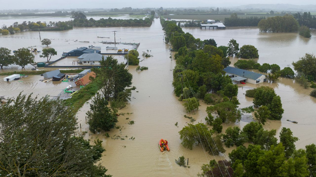
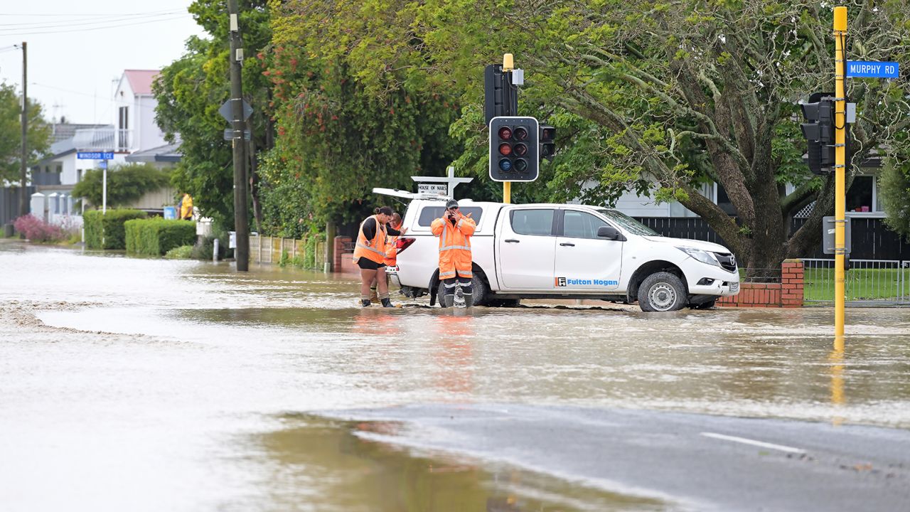
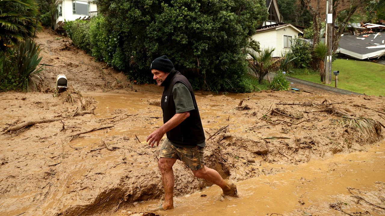
For the third time in its history, New Zealand issued a National State of Emergency on Tuesday as Cyclone Gabrielle pummelling the North Island with wind and rain, cutting electricity to tens of thousands of homes.
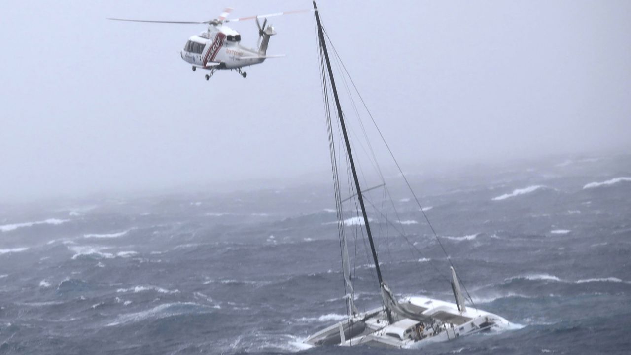
The New Zealand Meteorological Service reported wind gusts of over 140 kilometres per hour (87 miles per hour) along the coast and waves that were almost 11 metres (36 feet) high off the Bay of Islands.
The true scope of the catastrophe, according to Prime Minister Chris Hipkins, only became clear as the nation awoke on Tuesday.
In response to the magnitude of the recent tragedy, he told reporters, “What we have to do is make sure that we’re dealing with the most critical needs across the country as rapidly as we can.”
This most recent tragedy, which is caused by a weather system off the country’s north and is travelling south and east along the coast, has caused the third national state of emergency after the 2011 Christchurch earthquake and the Covid epidemic in 2020.
150 members of the New Zealand Defense Force joined forces overnight to help with the distribution of supplies and the evacuation of locals from regions where rising water forced some householders onto their rooftops. Tens of thousands of people lack electricity, and some locations have spotty mobile connection, making it challenging to organise services and get in touch with those who are left stranded.

Due to high winds, Air New Zealand cancelled all domestic flights to and from Auckland Airport for the rest of Tuesday, totaling 55.
With 175 millimetres of rain falling in the 24 hours leading up to 9 a.m. local time on Tuesday, Napier Airport, a regional airport farther south, scored its second wettest day ever, according to the Met Service. This is three times more rain than the February normal.
The eastern shoreline and nearby interiors of the North and South Island are expected to see gale-force winds for a further 24-36 hours before gradually ceasing by Wednesday afternoon.
Until Thursday, the southeastern parts of the North Island, including Wellington, can anticipate additional rainfall totals of up to 150 mm, while the South Island, just north of Christchurch, will have lower totals.